
Adelaide River
Alice Springs Mulga
Alpine Peatland
Arcturus
Beacon Farm
Boyagin Wandoo Woodland
Burdekin Delta
Calperum
Cape Tribulation
CIA (maize and wheat)
CIA (rice)
Collie
Cow Bay
Cumberland Plain
Daly River Pasture
Daly River Uncleared
Dargo
Dry River
French Island
Fogg Dam
Gatum Pasture
Gingin
Great Western Woodlands
Howard Springs
Kopuatai
Litchfield
Mangawhai
Mitchell Grass Rangeland
Nimmo
Otway
Oxford
Ridgefield
Riggs Creek
Robson Creek
Samford
Scott Farm
Silver Plains
Sturt Plains
Ti Tree East
Tumbarumba
Virginia Park
Wallaby Creek
Warra
Whroo
Wombat
Yanco
Yarramundi
![]() = external link, new window
= external link, new window
Introduction | Contacts | Publications | Purpose | Site Description | Measurements | DEM | Pictures
Site Description
The Tumbarumba flux station is located in the Bago State forest in south eastern New South Wales (GPS coordinates: -35.6566, 148.1517)
The forest is classified as wet sclerophyll, the dominant species is alpine ash (Eucalyptus delegatensis), and average tree height is 40m. Elevation of the site is 1200m and mean annual precipitation is 1000mm. The Bago and Maragle State Forests are adjacent to the south west slopes of southern New South Wales and the 48,400 ha of native forest have been managed for wood production for over 100 years.
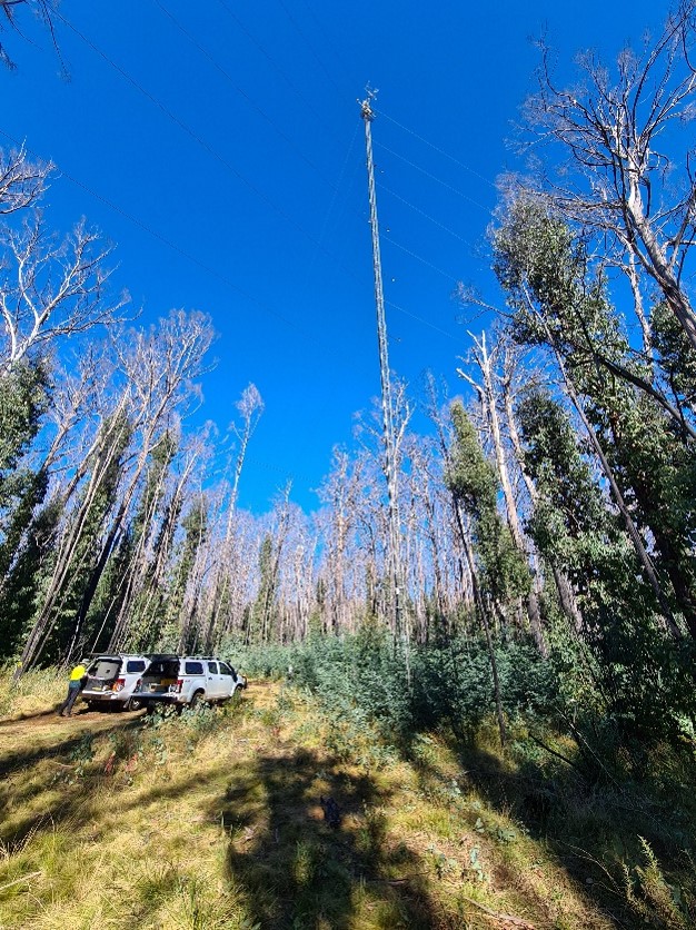
The instrument mast is 70m tall. Fluxes of heat, water vapour and carbon dioxide are measured using the open-path eddy flux technique. Supplementary measurements above the canopy include temperature, humidity, windspeed, wind direction, rainfall, incoming and reflected shortwave radiation and net radiation. Profiles of temperature, humidity and CO2 are measured at seven levels within the canopy. Soil moisture content is measured using Time Domain reflectometry, while soil heat fluxes and temperature are also measured. Hyperspectral radiometric measurements are being used to determine canopy leaf-level properties.
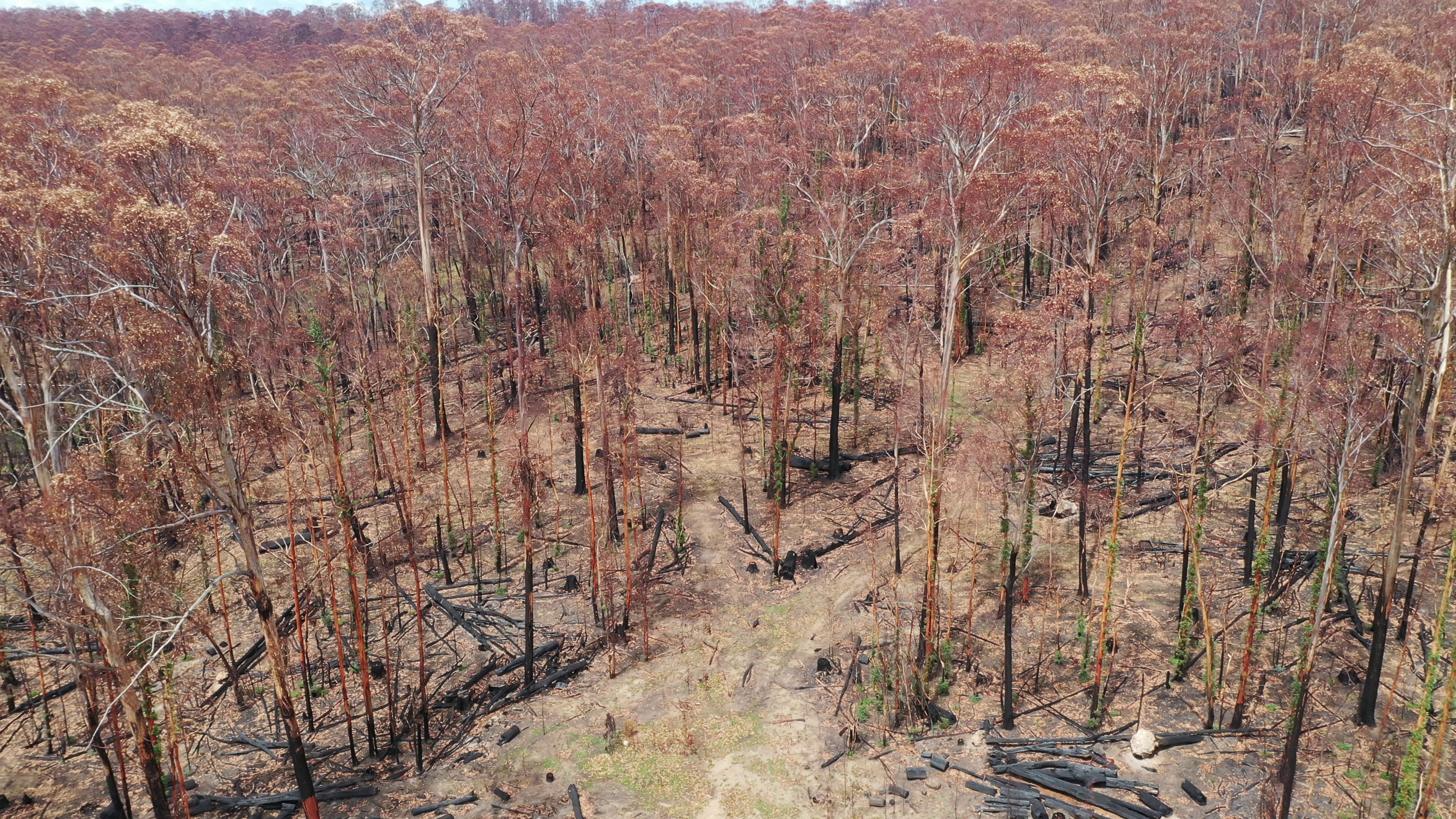
Bushfire Disturbance
On New Year's Eve 2019 (31/12/2019) a bushfire swept through the Bago State Forest with a moderate severity burn (full understorey consumption but no canopy consumption). Prior to the fire, the forest had been growing without major disturbance over a period of almost 40 years, enabling study of its response to ongoing smaller disturbances such as insect outbreaks, droughts, normal weather fluctuations and internal stand dynamics.
The regrowth forest is structurally and functionally different to pre-fire conditions. The fast ground-fire caused nearly 100% mortality of the ash tree species, where the mountain gum (Eucalyptus dalrympleana) species resprouted with epicormic growth. There are high levels of ash regenerating from seedlings and other eucalypt trees (mountain gum and peppermint) are rapidly re-sprouting. There were around 10 months of data gap after the fire.
Approximately 50 days after |
Dead alpine ash and mountain gum regrowth |
Supported by

A contributor to

Partner organisations