
2021-09: French Island
2021-07: Mitchell Grass
Rangeland
2021-06: Boyagin and
Ridgefield
2021-04: Warra
2021-03: Howard Springs
2020-11: Calperum
2020-10: Ashley Dene
2020-09: Alice Mulga and
Ti Tree East
2020-08: Wombat Forest
2020-07: Kopuatai Bog
2020-05: Gingin
![]() = external link, new window
= external link, new window
This month our site feature takes us to Australia's most southerly flux monitoring site, located in Tasmania's world heritage wilderness region. For almost a decade, equipment at the Warra site has been measuring the exchange of carbon, water and energy between the atmosphere and the tall eucalypt forests that dominate this iconic, biodiverse and immensely valuable wilderness region.
The Warra site was established as a Long-Term Ecological Research (LTER)  site in 1998. In 2013, an eddy-covariance flux tower was installed and the site became a TERN SuperSite and a member of the OzFlux network.
Data collected by the research infrastructure at the site are being used by researchers to understand ecosystem function and change over time. Specifically, the measurements allow research that links ecophysiological processes and rates of carbon accumulation and decomposition with the biota that reside within the forest system.
The site is managed by Dr Tim Wardlaw at the University of Tasmania with the assistance of Alison Phillips of Sustainable Timber Tasmania.
Warra: Australia's most southern flux monitoring site
The Warra flux tower is within the Warra LTER site located in the far south of Tasmania, making it Australia's most southerly registered flux monitoring site. Reaching 80 m height, it's also the tallest flux tower in OzFlux, and amongst the tallest in the world too! The Warra LTER covers approximately 15,900 ha and is comprised of alpine terrain, wild rivers and some of the world's tallest and most productive forest. The flux tower is located within a relatively flat patch of this forest on a floodplain of the Huon River.
The climate of Warra is cool temperate, characterised by mild summer temperatures that peak in January (min. 8.4 °C – max. 19.2 °C), and cool winter temperatures that reach their minimum in July (min. 2.6 °C – max. 8.4 °C). It's usually wet to some extent at Warra, with a mean annual rainfall of 1700 mm and no discernible dry season.
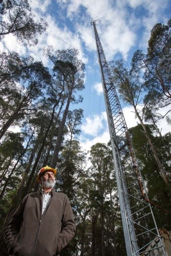
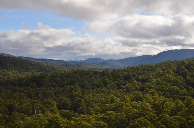
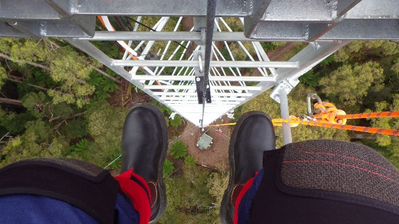
Tim Wardlaw standing at the base of the Warra flux tower (left, credit: The Australian), the view west from the top of the Warra tower showing the homogenous forest landscape that surrounds the site (top right, credit: Tim Wardlaw), view looking down from the top of the Warra tower (bottom right, credit: Cacilia Ewenz).
Rich biodiversity and a history of harvesting at Warra
The overstory at Warra is dominated by Eucalyptus obliqua , a tree species that attains a mature height greater than 55 m and can reach up to 90 m under ideal growing conditions. This forest type has occupied the landscape around Warra for at least the last 50,000 years and is at the far southern range of Australia's temperate forest ecosystems.
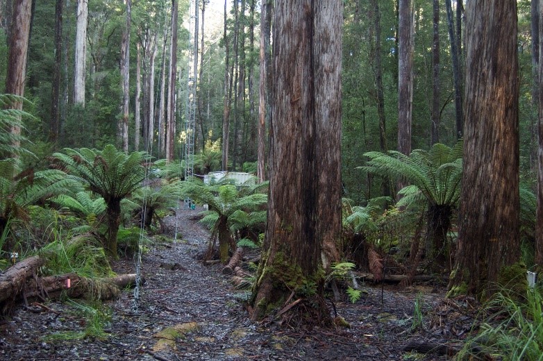
While E. obliqua dominates the overstory at Warra, the understory is comprised of a mix of wet sclerophyll and rainforest species, including Dicksonia antarctica , Acacia melanoxylon , Nothofagus cunninghamii , Atherosperma moschatum , and Pomaderris apetala . The relative abundance of these understory species varies depending on time since fire and the local patterning of fire intensity.
Coinciding with its rich biodiversity is a history of timber harvesting at Warra, which began in the 1970s. Over the years, harvesting practices have been developed and refined to sustainably manage wood production from these highly productive Tasmanian forests.
'The evolution of our understanding of natural disturbance in the Tasmanian range of tall eucalypt forests is guiding the way forestry is done.' – Dr. Tim Wardlaw
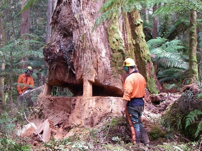
Understory vegetation and woody debris at Warra (left, credit: Mirko Karan), and felling a mature E. obliqua in preparation for erecting the Warra flux tower (right, credit: Leigh Edwards)
It's cool, it's wet, yet it still burns
Despite the cool and wet climate at Warra, the site experiences periodic disturbance from fire, which shapes and maintains vegetation structure and coarse woody debris inputs to the system. These fires do not typically replace the overstory vegetation, but they are destructive to the understory. While they are a common occurrence in Tasmania's world heritage forests, little is known about the conditions under which these fires burn or the lasting effects they have on forest recovery and biodiversity. Research activities at Warra are helping to close this understanding gap, with a recent article published in the journal Fire showing the story through measurements of a fire that burned through the site in January 2019.
The fire started from a dry lightning strike and burnt a total of 64,000 ha of land, which included the Warra OzFlux and TERN SuperSite. Monitoring in the days leading up to the fire showed weather conditions were mild, resulting in a moderate fire danger. When the fire hit the SuperSite, air temperature and CO2 emissions peaked before the monitoring equipment shut off due to a burnt power cable. While the fire itself was considered low intensity, it still consumed fine fuels and ground vegetation and resulted in crown scorch of the understory trees and some of the overstory. This resulted in a sustained reduction in leaf area index in the aftermath of the fire, with the ecosystem switching from a carbon sink before the fire to a carbon source post fire as the ecosystem recovered.
The 80m tall monitoring tower survived the fire, but a large amount of NCRIS-enabled TERN monitoring infrastructure was destroyed. Soil sensors, bio-acoustic recorders, dataloggers, power and communication cables, either melted or irreparable. The nearby iconic Tahune Airwalk, almost completely ruined.
'We have been waiting for two decades to measure and monitor a natural fire event in the forests at Warra from time zero. TERN's infrastructure has provided unprecedented detail of the fire event and changes it caused to the forest.
We now have a quality time-series dataset on the exchanges of water and carbon from the site's flux tower before, during and after the fire event, which was the first in this forest since 1898!
Such data are very rare globally and may challenge some of our assumptions about carbon losses during fires.
When combined with the extensive information on soils, vegetation structure and composition and species occurrence collected on the ground by TERN, these data are immensely valuable for understanding the functioning and resilience of Australian ecosystem to fire.' – Dr. Tim Wardlaw
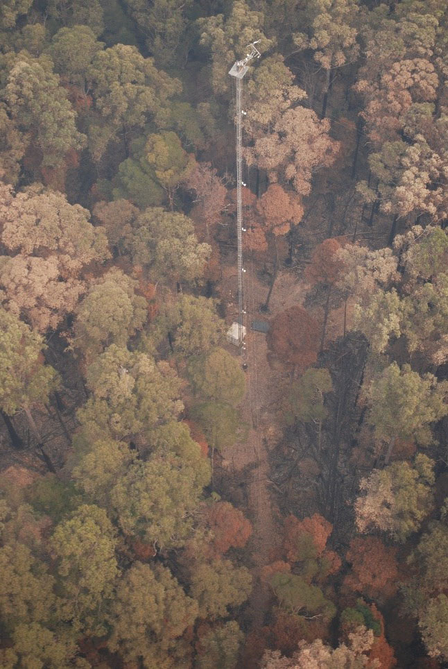
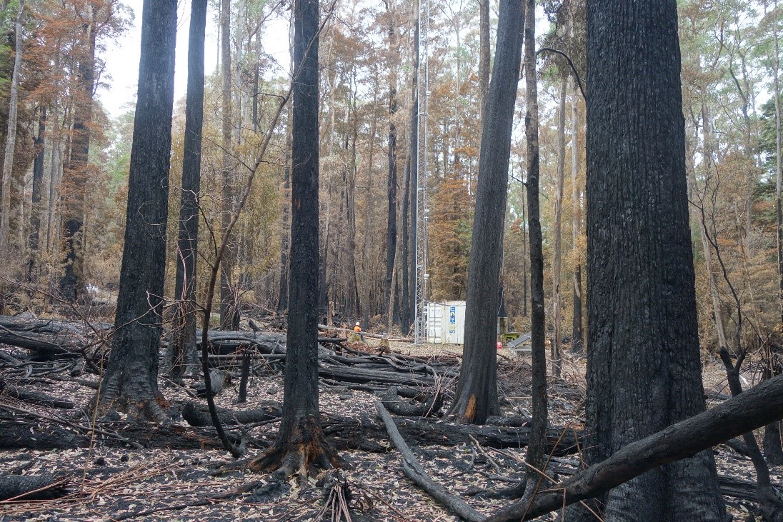
View from above (left, credit: Marti Piesse) and view from below (right, credit: Tim Wardlaw) in the aftermath of the 2019 fire at Warra.
Supported by

A contributor to

Partner organisations